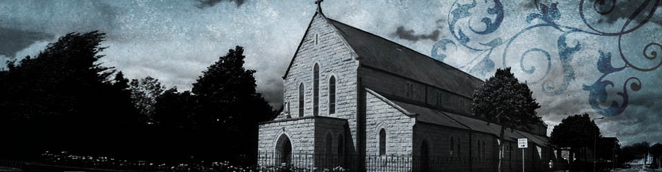
Donore Avenue Parish is situated in the Liberties area of South West Inner City Dublin. Initially the area was part of the Parish of St. Catherine’s Meath Street. In 1946 Donore Avenue parish was established. The Marist Fathers came to Donore Avenue Parish in 1980. At present there are four Marists living in the community attached to the parish.
Geographically the parish of Donore Avenue is made up of clearly distinct districts, which developed at different times and in different ways. Donore Avenue was originally named Love Lane. Initially the area was part of the Parish of St. Catherine’s, Meath Street. The granite-faced church was built in 1924 and was later extended to cater for the growing population in the area. In January 1946 it was constituted a parish in its own right.
The main geographical areas of the parish can be defined as:
- The Tenters
- Cork Street and Maryland
- South Circular Road from the Mosque to Player Wills factory
- St Teresa’s Gardens, Chamber Court and Weaver Court
Historical Background
The parish is in one of the most historically rich areas of Dublin with associations going back to Viking times. The Vikings made their first raid on Lambay Island in A.D. 795 but did not settle there permanently until A.D. 841. Baile Átha Cliath is the ancient Irish name for Dublin and it means literally ‘the town of the ford of the hurdles’. The Vikings built the town they called Dubhlinn, named after the Black Pool, which was formed by the meeting of the rivers Poddle and Liffey. By A.D. 988 the town was captured by the Irish king, Mael Shechnell, and made into a city. Viking Dublin stretched between Wood Quay, Winetavern Street, Christ Church and Fishamble Street. The Liberties: The story of the Liberties dates back to the 12th century. Shortly after the murder of Thomas à Becket, the Archbishop of Canterbury, King Henry II came to Ireland and visited the ancient church of St. Catherine. The king declared that an abbey be founded in memory of Thomas à Becket. The founders of the monastery, the Augustinian monks, were given complete freedom of city laws, i.e. they did not have to pay rates or taxes. This first ‘Liberty’ spread out to take in the lands of Donore. This area became known as the Liberty of Thomas Court and Donore, and had its own palace, prison, courts and hospital. All residents within the area were completely free from city laws. The Liberties came to mean different areas of Dublin at different times. These liberties vary in size; Christchurch Liberty is the smallest, consisting of only one acre while the Liberty of Donore covers 380 acres. In 1828, the Liberty of Donore extended way beyond the South Circular Road and the canal to reach Tonguefield on the Poddle, coming back along the Dark Lane (now Sundrive Road) to reach Dolphin’s Barn and Cork Street. What we know as the Liberties today, roughly speaking, are bounded by Dublin Castle, the Quays, James’s Gate and Blackpitts.
The Tenters
At a later stage in its history the Liberties became a Huguenot settlement. The Huguenots were French Protestants who suffered religious persecution and fled to Ireland in 1685. They were skilled weavers who created an industrial centre in the area. They started their business around the area now called Weaver’s Square. They taught the people of Dublin how to weave silk and poplin. At first, everything seemed to prosper and many more people came to live in the area. However, difficulties arose because of the Irish weather. The cloth needed to be stretched and dried on tenter hooks in the fields between what is now O’Curry Avenue and Clarence Mangan Road. In 1814 Thomas Pleasants built a stone Tenter House on the land between Cork Street, Brickfield Lane, Brown Street and Ormond Street. The success of Dublin poplin was disastrous for the English cotton and woolen industries. The English Government issued new rules (no material may come to Ireland without first coming through England) and new taxes. This eventually caused the weaving industry in Dublin to decline. This area was still an open field at the beginning of this century. After the decline of the linen trade, the land was used for market gardening until the houses in the Tenters were built around 1922; the year of construction has been marked on the front walls of some of the houses. Many of the street names in the Tenters have literary associations, e.g. Oscar Square (after Oscar Wilde), Clarence Mangan (after James Clarence Mangan, the poet), Ingram Road (after Sir John Kells Ingram, the poet). The houses in Rutledge Terrace were built between 1898 and 1910 by Robert and Andrew Rutledge, the same builder who built houses in Francis Street and Golden Lane.
Cork Street and Maryland
The name Cork Street dates before 1728 and runs from Ardee Street to Dolphin’s Barn Street at the junction with Emerald Square. On old maps it is described as ‘The Highway to Dolfynesberne’. It is part of the old Slighe Dála. The name Cork comes from the Boyle family, Earls of Cork. Cork Street, like South Circular Road, is made up of groups of houses built at different times, each with individual names. It also has a considerable number of cul de sacs branching out from it, resulting from private developments constructed in the back gardens of larger residences. With the exception of Marrowbone Lane, all the roads or lanes on the north west side of Cork Street are very short because of the adjacent old city boundary which ran along the back of Cork Street and can be seen at Pyro Villas. Cork Street contains a number of important buildings. The decline of the weaving trade meant that the old Tenter House was vacant. In 1861 a Carmelite priest bought the house and opened it as a refuge for the homeless. He ran the hostel for ten years until 1871 when the Sisters of Mercy came to Cork Street. In 1873 they built a convent and in 1874 a primary school, which closed down in 1989. The Mercy Family Centre used the building up to 2003. In the 2004 the old school was demolished and a new purpose build Family Centre has been build to continue this work. The Fever Hospital and House of Recovery is today Brú Caoimhín, an old people’s home run by the Eastern Health Board. It was originally opened by the Quakers on 14 May 1804 in a field of almost three acres. In 1960 the hospital was moved to Cherry Orchard, Ballyfermot. Across the road is the James Weir Home for nurses built in 1903. The site was a Quaker burial ground and several gravestones are still visible. Cork Street was an important industrial centre. Perhaps one of its most important firms was the Cork Street Foundry and Engineering Works of William Dspence. WEL Electric occupy the premises today.
Maryland is the biggest housing development off Cork Street in the parish. The houses were constructed about ten years after the Tenters, around 1932, a Marian year; hence the name Maryland. The Corporation built the houses, some of which were privately purchased. Vehicular access is via Marrowbone Lane and St. James’s Walk, although Vauxhall Avenue (formerly Vauxhall Cottages – no houses remain today) provides pedestrian access.
South Circular Road
The South Circular Road dates from 1773 and originally contained detached houses and market gardens with the Toll House situated at the corner of Dolphin’s Barn Street and South Circular Road, Rialto. The group of houses on this road today were built by a variety of builders at different stages and have individual names for each section or terrace. Donore Terrace, Nos. 167–195, 216–244 South Circular Road was built in 1881 and gets its name from the Liberty of Donore. Today many of these houses are subdivided into flats and only a small minority remain family homes. For many years South Circular Road was known as ‘Little Jerusalem’. At the turn of the century the total Jewish population in the area numbered 5,000. These Jews originally came to Dublin from Lithuania, Latvia, Estonia and Russia to avoid persecution. Many of them were young and penniless, entering the scrap trade or clothing business. The synagogue at 228 South Circular Rd is now used by Mason Technology. Across the road from the synagogue is what was the Donore Presbyterian Church. Constructed in the 1860’s, its style is of a 13th century English church. Due to a declining congregation, the church was amalgamated with that of Adelaide Road in 1980. In 1984 the church reopened as the Dublin Mosque and the adjoining building houses the Islamic Information Centre. A church of the Church of Ireland is located just off South Circular Road.
St. Teresa’s Gardens, Chamber Court and Weaver Court
The flat complexes of St. Teresa’s Gardens, Chamber Court and Weaver Court are the most recently developed areas of the parish. The area now occupied by St. Teresa’s Gardens was formerly open fields, called Day’s Field, where horses were held and trained. The 360 flats were constructed by Dublin Corporation in 1950. At the time of construction, the flats were considered modern and were much sought after. Parish records show quite clearly that most of the people were employed right up to the 1960’s in a variety of jobs. The Chamber Court and Weaver Court complexes were built in the 1960’s. Chamber Court has 58 flats in two separate blocks while across the road Weaver Court has 36 flats in a single block. This area is currently undergoing many changes. The Corporation has just completed building houses linking Weaver Court with the rest of Chamber Street. Across the road there is a private development of over 60 apartments built beside the Mercy Sisters’ Convent in the old Weaver Square school building. Cork Street is now part of a new multi-lane carriageway with a lot of building development taking place.
It is quite clear that the Parish of Donore Avenue area has changed considerably over the course of its long history.
(1) The Donore Avenue was an important economic and agricultural area of Dublin, not just in distant history, but right up to recent decades. Unemployment is a relatively new phenomenon.
(2) The area has a history of great religious diversity. At different times in this century it has been home to two of the most significant religious and cultural minority groups in Ireland: the Jewish and Muslim communities.
(3) The area is socially diverse. The private housing areas of South Circular Road, Maryland and the Tenters and Dublin City Council Social housing of St. Teresa’s Gardens, Weaver Court and Chamber Court.